

Application Description
Embark on your next adventure with our comprehensive guide to hiking, cycling, skiing, and exploring the Alps, whether by car or public transport. Our app is your ultimate companion, ensuring you have all the tools you need to plan and enjoy your journey.
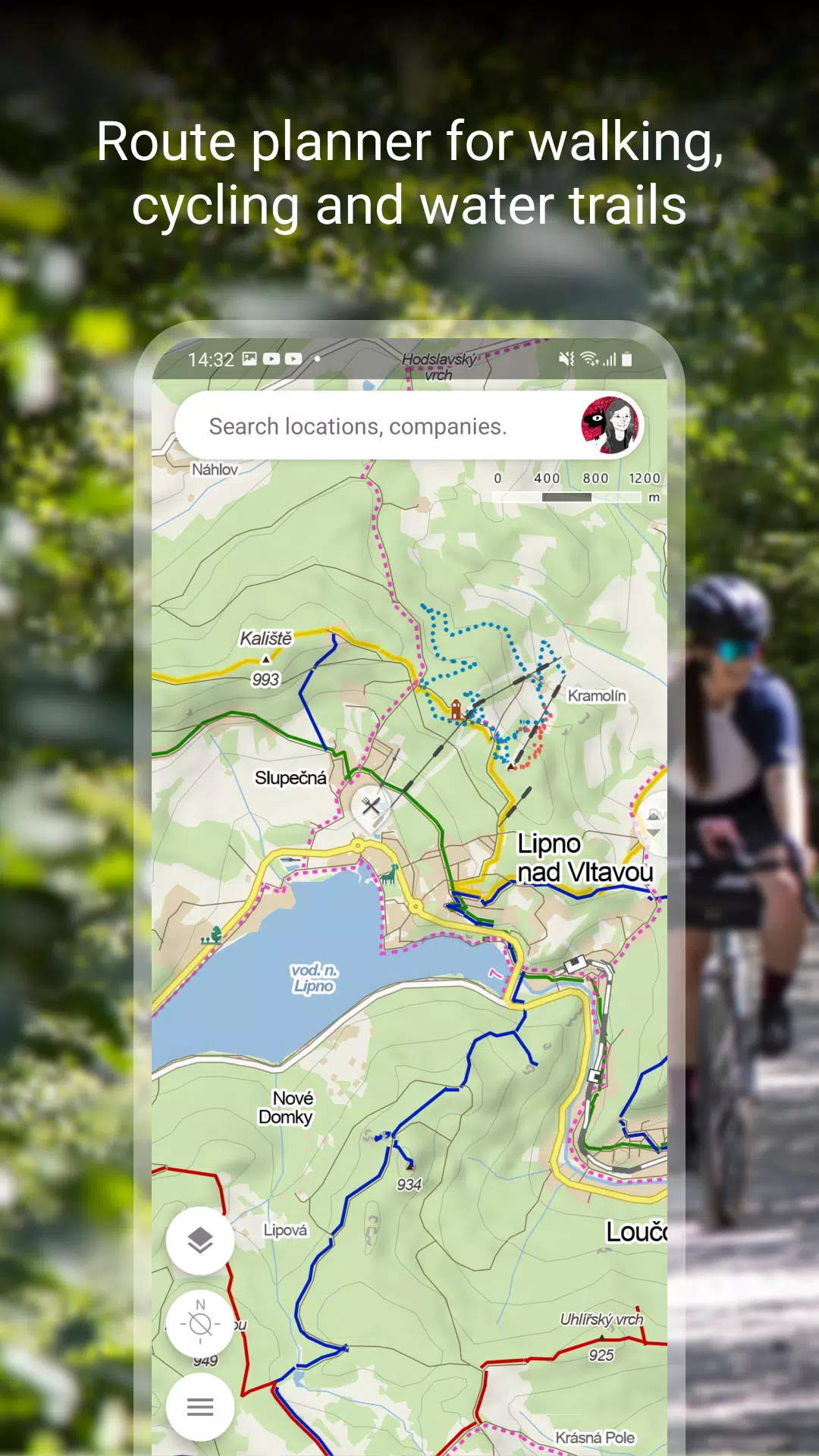
Plan Your Route
Our route planning feature is designed to help you navigate the great outdoors with ease:
- Explore detailed hiking and cycling trails to find the perfect path for your adventure.
- Discover cross-country skiing and ski-alpine trails to enjoy winter sports in stunning landscapes.
- Utilize our unique “travel tips” feature, which crafts a personalized trip through the most captivating spots in the area.
- Check the route elevation profile to prepare for the challenges ahead.
- Stay updated with 5-day weather, temperature, wind, and precipitation forecasts for any location on Earth.
Browse the Tourist Map of the Whole World
Navigate the world with our comprehensive tourist map, featuring:
- Hiking trails, bike trails, singletracks, and single trails for outdoor enthusiasts.
- Detailed marking of roads, mixed cycle paths, unpaved paths, and footpaths to guide your journey.
- Hillshade views of any global location, along with marking of ferrata and their difficulty for climbers.
- Educational trails, pedestrian closures, and national park zones to enhance your knowledge and safety.
- Routes for wheelchair users ensuring accessibility for all.
Switch to Other Map Layers
Enhance your navigation with additional map layers:
- An aerial map of the world for a bird's-eye view of your destination.
- Panoramic images of Czech streets and 3D views for immersive exploration.
- Winter maps with real-time updates on cross-country ski trails and ski resorts.
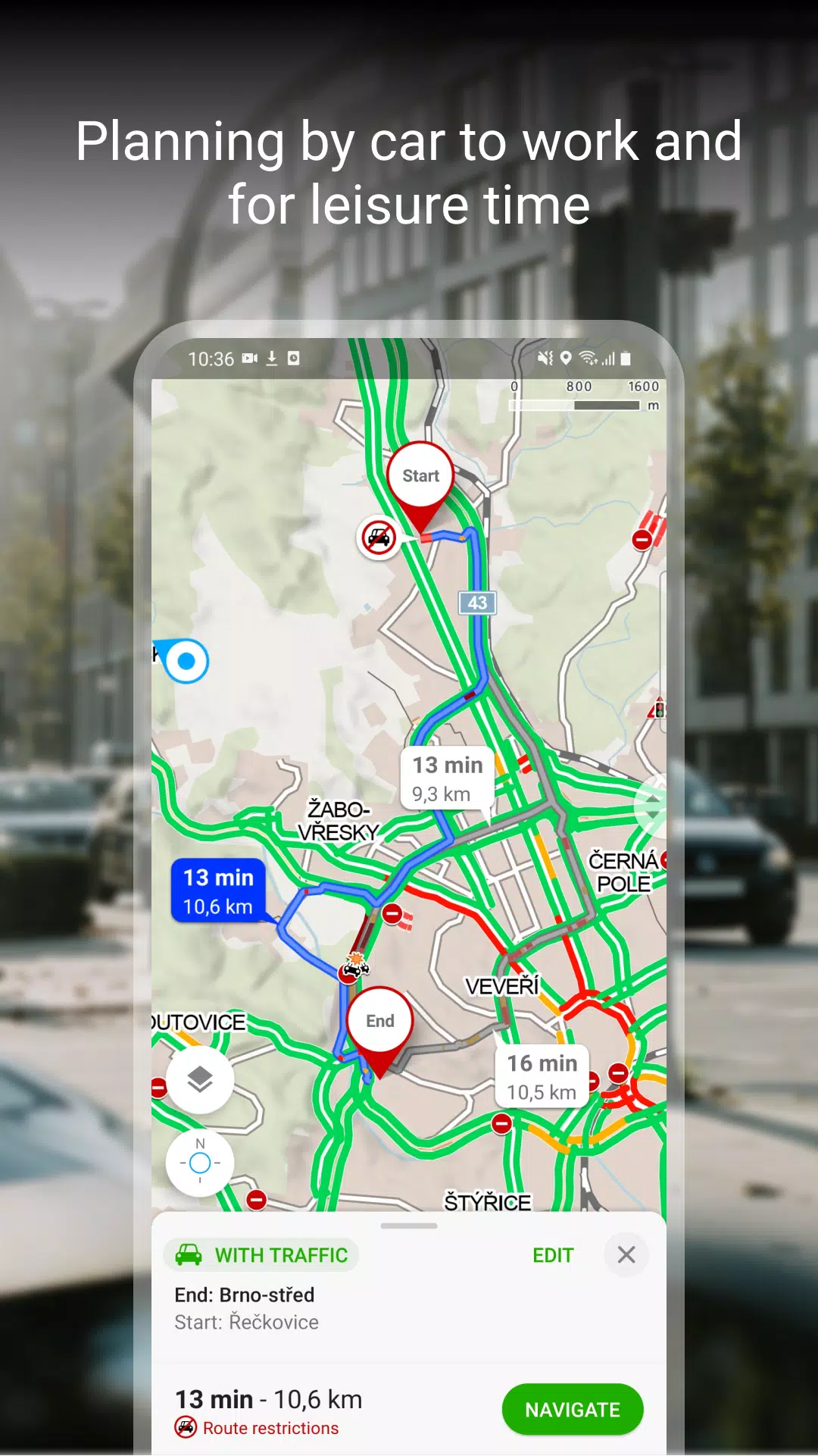
- A traffic map providing current traffic conditions, closures, and parking zones in the Czech Republic.
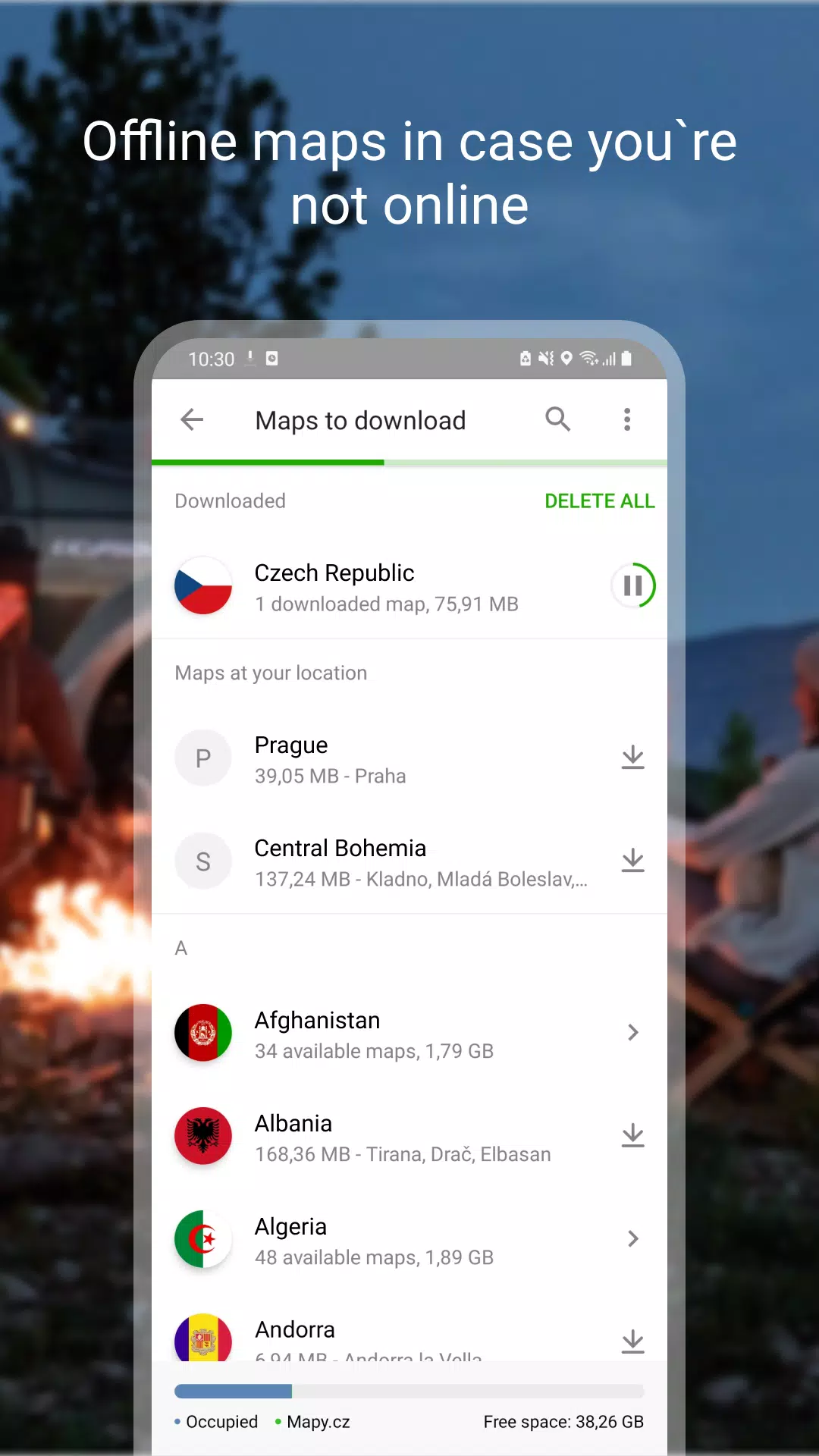
Download Offline Maps
Ensure you're never lost, even without an internet connection:
- Download an offline tourist map of the whole world with hiking and cycling trails.
- Enjoy offline voice navigation tailored for drivers, cyclists, and pedestrians.
- Access offline winter maps of the Czech Republic with detailed cross-country skiing trails and ski resorts.
- Download individual regions for focused navigation and exploration.
- Search for places and plan routes worldwide, even without a signal.
Free Navigation for Drivers, Cyclists, and Pedestrians
Navigate with confidence using our free navigation features:
- Receive clear instructions on which lane to enter.
- Benefit from highlighted roundabout exits for seamless navigation.
- Optionally avoid toll lanes to suit your preferences.
- Switch to dark mode for comfortable night-time driving.
- Share your arrival time, route, and current location via SMS, email, or chat.
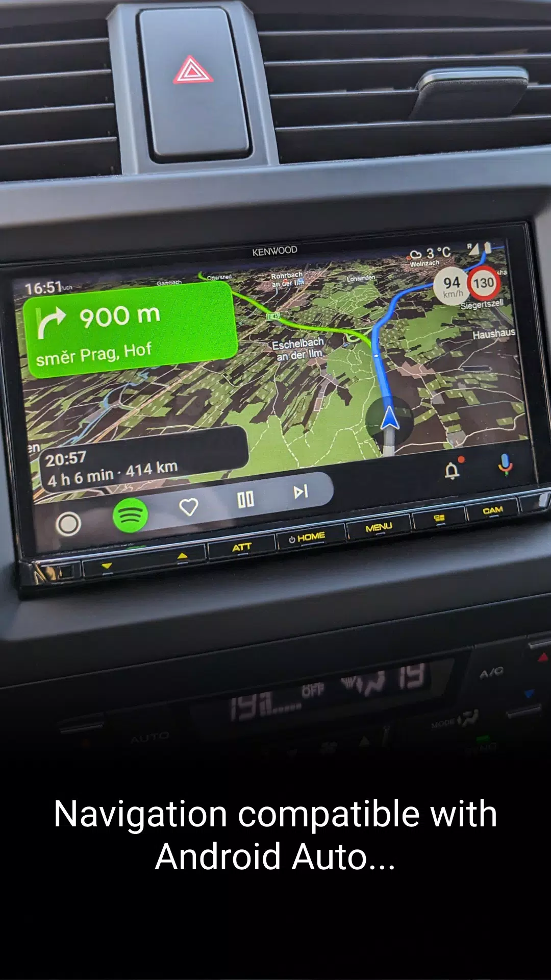
- View navigation on your car's large on-board display using Android Auto or Apple CarPlay.
- Stay informed with speeding alerts and speed camera notifications in the Czech Republic.
- Receive important notifications from other drivers about accidents, police patrols, roadblocks, road closures, and roadworks in the Czech Republic.
- Get real-time updates on traffic situations in the Czech Republic, including traffic jams and alternative routes.
- Be alerted to sections of frequent traffic accidents and areas without winter maintenance on Czech roads.
Save to My Maps
Organize and track your adventures with ease:
- Save places, routes, photos, and activities in clearly organized folders.
- Track your activities with our Tracker for walking, cycling, running, cross-country skiing, and hiking.
- Use GPX file upload, import, and export for seamless data management.
- Ensure your planned routes are synchronized across devices for a consistent experience.
Choose by Reviews of Places, Restaurants, and Services
Make informed decisions with our user-driven review system:
- View up-to-date user photos to see what a place really looks like.
- Read about users' experiences with food, service, ambiance, and price.
- Search by rating level and highlight top-rated establishments for the best choices.
Recommendations and Tips:
To make the most of our app:
- You will need an internet connection to download maps.
- Ensure location services are enabled in your phone settings for accurate navigation.
- For the location sharing function, the app will require access to background location data.
- Use the form in the app settings for questions or troubleshooting.
- Be aware that using the app in the background with GPS running can reduce battery life.
- Join our user community at www.facebook.com/Mapy.cz/ to share your experiences, stay updated with the latest news, or suggest new features.
Mapy.cz: maps & navigation Screenshots
Reviews
Post Comments
Trending Games
Trending apps


Topics
More
Explore the World of Casino Games
Personalize Your Android: Top Apps for Customization
Top Travel Planning Applications
Exciting Action Packed Games for Android
Unique Wallpaper Apps for Every Style
Top Productivity Apps to Streamline Your Workflow
Explore the World of Casino Adventure Games
Personalize Your Android Experience with These Apps
Latest Articles
More


Sovl: Fantasy Warfare Launches on iOS
Apr 16,2026
inZOI Reveals Massive Game Scope
Apr 08,2026