

Application Description
Navigating through bustling cities or unfamiliar places has never been easier, thanks to the comprehensive 2GIS app. With its offline maps, GPS navigation, real-time traffic updates, parking information, and transit routes, you'll have everything you need to get around effortlessly.
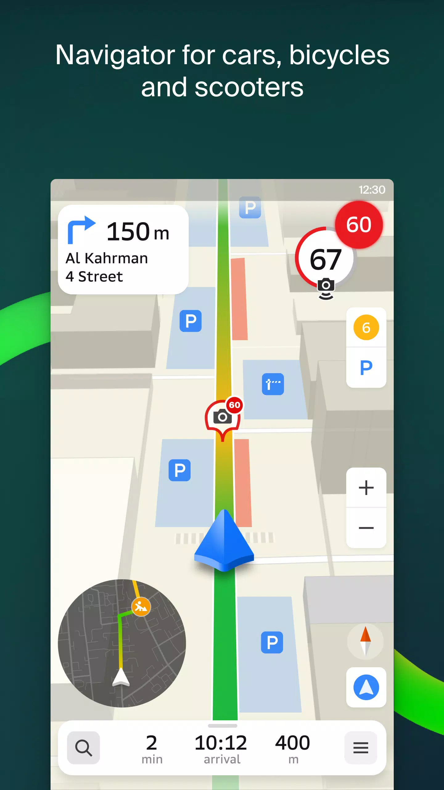
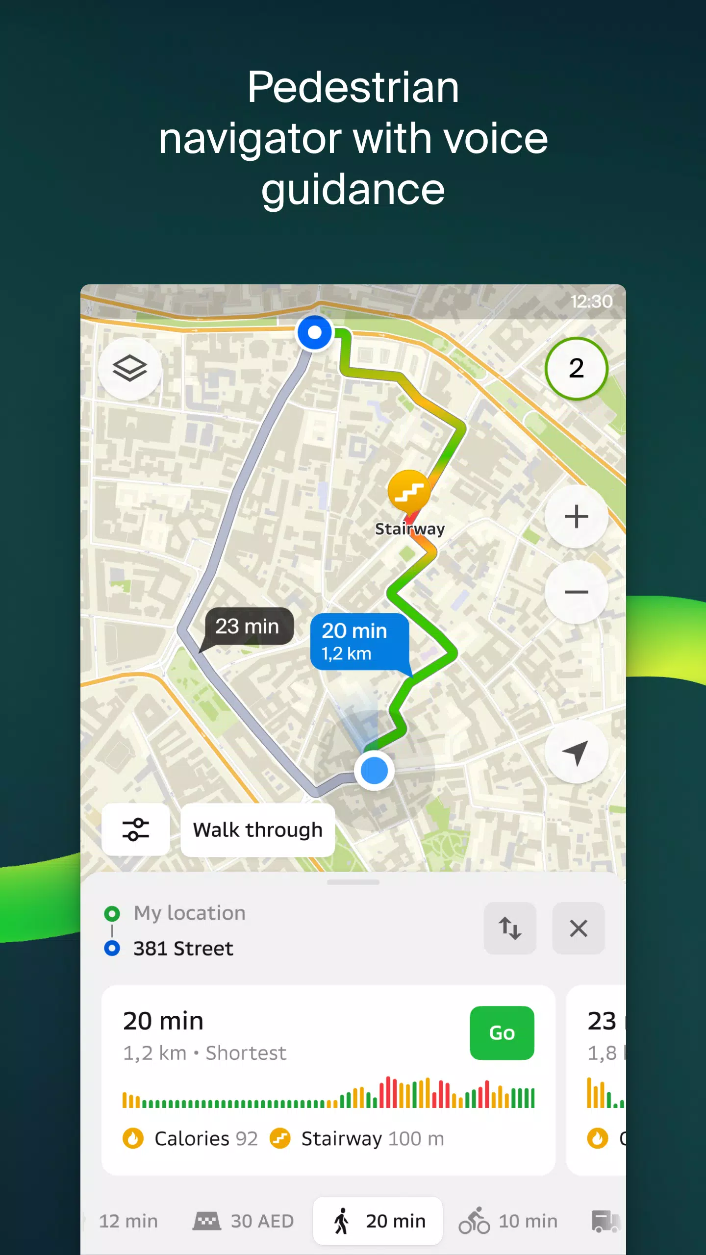
2GIS offers a detailed map complete with GPS navigation for both car drivers and pedestrians. You can access it online or download it to your device, ensuring you never lose your way, even without an internet connection. Whether you're exploring new cities or navigating your hometown, 2GIS makes you feel right at home:
- Easily locate addresses, companies, phone numbers, operating hours, and find goods or services.
- Get directions by car, bus, subway, or follow pedestrian navigation routes.
- Find building entrances and nearby parking lots.
With accurate maps, you can pinpoint districts, buildings, streets, bus stops, subway stations, gas stations, sports grounds, and more. The GPS navigation feature takes into account live traffic conditions, road signs, speed cameras, toll roads, and unpaved roads. It can plan routes between cities and through multiple points, and there's even a free app available for Android Auto.
Safety and connectivity are enhanced with features like live friend location tracking. You can locate your kids or friends on the map, ensuring their safety with real-time GPS tracking. Share fun stickers, check battery levels, and manage who you add as friends and share your location with.
Stay informed with real-time road events, including accident reports, blocked streets, and speed camera alerts, all displayed directly on the map. For public transport users, 2GIS provides up-to-date timetables and online routes. Pedestrians can enjoy background navigation with voice guidance, while truck drivers benefit from cargo-specific navigation that considers vehicle and cargo characteristics.
The detailed directory within 2GIS includes addresses, entrances, postal codes, phone numbers, operating hours, social media links, websites, and entrance locations. Users can add photos and write reviews, enhancing the community experience. Additionally, the travel guide feature helps you discover main attractions, Wi-Fi spots, and more, all mapped out for your convenience.
For Wear OS smartwatch users, the 2GIS Notifications companion app provides a seamless navigation experience. View maps, receive maneuver hints, and get vibration alerts when approaching turns or destination bus stops. The app automatically starts when you begin navigation on your phone and is compatible with Wear OS 3.0 or later versions.
Available maps cover numerous cities across the UAE, Russia, Belarus, Kazakhstan, Uzbekistan, Azerbaijan, and Kyrgyzstan, including:
- Cities of the UAE: Dubai, Sharjah, Abu Dhabi, Al Ain, Ajam, Ras Al Khaimah, Fujairah, Umm Al Quwain, Dibba Al Fujairah, Khor Fakkan, Kalba, Al Salamh, etc.
- Cities of Russia: Moscow, Saint Petersburg, Novosibirsk, Ekaterinburg, Krasnoyarsk, Chelyabinsk, Ufa, Omsk, Kazan, Perm, Nizhny Novgorod, Sheregesh, etc.
- Cities of Belarus, Kazakhstan, Uzbekistan, Azerbaijan, and Kyrgyzstan: Minsk, Pavlodar, Semey, Aktau, Aktobe, Almaty, Nur-Sultan, Bishkek, Karaganda, Kokshetau, Kostanay, Osh, Baku, Tashkent, etc.
For any support inquiries, feel free to reach out to [email protected].
2GIS: Offline map & navigation Screenshots


Reviews
Post Comments
Trending Games
Trending apps


Topics
More
Explore the World of Casino Games
Personalize Your Android: Top Apps for Customization
Top Travel Planning Applications
Exciting Action Packed Games for Android
Unique Wallpaper Apps for Every Style
Top Productivity Apps to Streamline Your Workflow
Explore the World of Casino Adventure Games
Personalize Your Android Experience with These Apps
Latest Articles
More


Sovl: Fantasy Warfare Launches on iOS
Apr 16,2026
inZOI Reveals Massive Game Scope
Apr 08,2026